123Fab #35
1 topic, 2 key figures, 3 startups to draw inspiration from

In February, Estonian start-up Hepta Airborne raised €2 million to take its drone powerline inspection solution to the next level. Using LiDAR, thermal sensors and cameras, Hepta Airborne helps automatically detect powerline and power infrastructure defects. This fundraising embodies the current surge in the use of drones for difficult tasks in the industry. Indeed, the overall commercial drone market is projected to reach $43 billion by 2024, up from $587 million in 2016. The volume of VC investments has increased by 21% over the past 4 years, reaching $185 million in 2020. In the coming years, the market is expected to become more concentrated, with the leaders winning out over weaker players, as did the fast-growing start-up Airobotics, which raised a total of $123M in funding over 5 years.
Drones are used in a variety of industries, but above all in 4D situations: dirt, dull, distant, and dangerous. The main industries that use them are the energy sector (both oil & gas and renewables), precision agriculture, construction, and mining. Although regulations are often a hindrance, there are gradually being adapted to each industry and use case, in order to enable the effective use of drones.
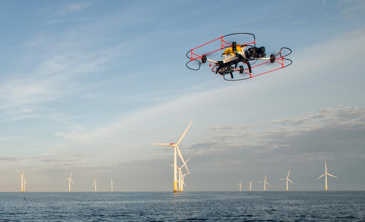
The energy sector can greatly benefit from drone inspections, which not only help to reduce costs, but also to prevent disasters and save lives. Indeed, they allow distant and dangerous inspections to be carried out, eliminating the need for climbing wind turbines or reaching offshore oil platforms. Although standards for drone operations are yet under development, they could help expand the use of unmanned aircraft services in the energy industry and boost innovation. The main challenge, however, lies in flights beyond the visual line of sight (BVLOS) – to carry out pipeline and powerline inspections over long distances, for instance – as the detect-and-avoid technology is not sufficiently advanced. Improvements in advanced EO/IR [electro optical/infrared] sensors, acoustic sensors, machine learning, ground-based radar, and other technologies could change the game. Avitas Sytems, a General Electric venture, has developed a digital platform and drone inspection capabilities for pipelines, for instance. Wind turbine inspection can be monitored by drones, such as those of the start-up Aerialtronics.
Drone activity in agriculture continues to increase, and the aerial imagery generated can provide unique insights by scouting crops, reporting crop damage, or determining tile locations. Drone use is mainly justified by a more accurate collection of crop data and the avoidance of dull stains. Over the past ten years, the Federal Aviation Administration (FAA) has continued to review the requirements for the operation of small unmanned aerial systems to create a reasonable legal pathway for use in agriculture. This involves obtaining a remote pilot certificate, registering the drone with the FAA, but also weighing less than 55 pounds, maintaining a maximum altitude of 400 feet, and remaining within the visual line of sight of the remote pilot or visual observer in command. Although these regulations seem restrictive, they enable farmers to use them as part of their needs. The Swiss start-up Gamaya uses HSI (Hyperspectral Imaging) technology deployed using small unmanned aircraft systems for remote sensing and high-resolution imagery. It can be used to diagnose crop diseases, the proliferation of invasive species, and environmental stresses.
As for drones in the construction industry, they are mainly used for surveying and inspection purposes. They perform dull, dangerous, distant, and time-consuming tasks. Drones are equipped with downward-facing sensors, such as RGB, multispectral, thermal, or LIDAR, and capture a large amount of aerial data in a short time. According to a PwC study, the use of drones throughout a construction project provides an unparalleled record of all activities; cuts planning and survey costs; increases efficiency and accuracy and eliminates disputes over the status of a project at a given point in time. Drafted regulations in the construction industry frame the use of drones, without preventing it. Drones can only fly during daylight, must be close enough to the operators to be seen by the naked eye, and cannot exceed a certain altitude and speed. The Swiss start-up Wingtra, which has raised a total of $19M, provides mapping drones for construction sites.
Finally, drones in the mining industry help solve challenges such as better blast optimization, improved safety, faster surveying, and the construction of the most comprehensive and continuous project datasets. On mining sites, drones are used to cover distant areas where foot traffic is not allowed. Their aerial photography and remote sensing allow mining companies to capture all that information without putting someone at risk.
All these examples highlight the significant potential of drones in the industry. Apart from regulation issues, the main factors limiting the massive adoption of drones are technical issues (battery autonomy, drone fleet management, data transfer, etc.) and practical issues (lack of certified pilots, hence the creation of marketplaces for drone rides).
To conclude, the potential of the drone market is high and has not yet reached maturity, and private investors are betting on it. Harmonization of regulations is underway – for recreational drones, the EU announced a continent-wide standardization on January 1st; and technology innovations (battery life, collision avoidance, autopilot, data processing, control & communication systems) should follow to enable democratized use in the industry.
2 Key Figures
1,009 drone startups
registered by Tracxn
Market size expected to reach $43bn by 2024
The market size of commercial drones is expected to reach $43bn by 2024, a CAGR of over 20% from 2018
3 startups to draw inspiration from
This week, we identified three startups that we can draw inspiration from: Percepto, Asylon, and SkySpecs.

Percepto
Percepto is a developer of autonomous drone technology for inspection and surveillance. The company has developed solution to holistically inspect and monitor industrial sites, harnessing remote robotics to autonomously collect, aggregate, and analyze visual data. Percepto operates in mining, oil & gas, industrial sites, and solar energy production sites.

Asylon
Asylon manufactures and distributes a range of field deployable infrastructure to its clients. Among others, the company manufactures DroneHome, a field-deployable battery swap station. It offers data linking, coverage, mesh networking, and mixed fleet support. Asylon has chosen a robot-as-a-service model, where they provide an end-to-end solution for an annual subscription.

SkySpecs
SkySpecs is a provider of autonomous drone inspections for onshore and offshore wind turbines. The safety software services include the development of an automated drone inspection feature for applications in wind turbines, utility and other infrastructure operations and maintenance activities and provides an analytics platform that supports workflows at every level of the value chain.
